Surrounded by 850,000 acres of National Forest, you’ll find the perfect blend of picture perfect scenery in the quietness of nature and unrivalled outdoor adventures.
Location: Northern Bayfield County, WI
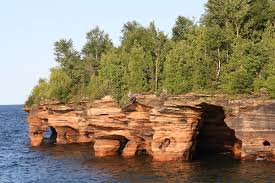
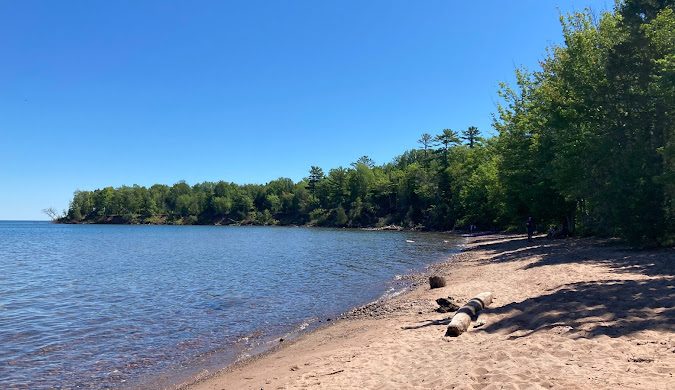
Apostle Islands National Lakeshore, located at the northern tip of Wisconsin’s Bayfield Peninsula, features 21 stunning islands, a scenic 12-mile shoreline along Lake Superior, and is located within the ancestral homeland of the Ojibwe people. Established in 1970, the park showcases picturesque sea caves, sandy beaches, and the largest collection of lighthouses in the National Park system.
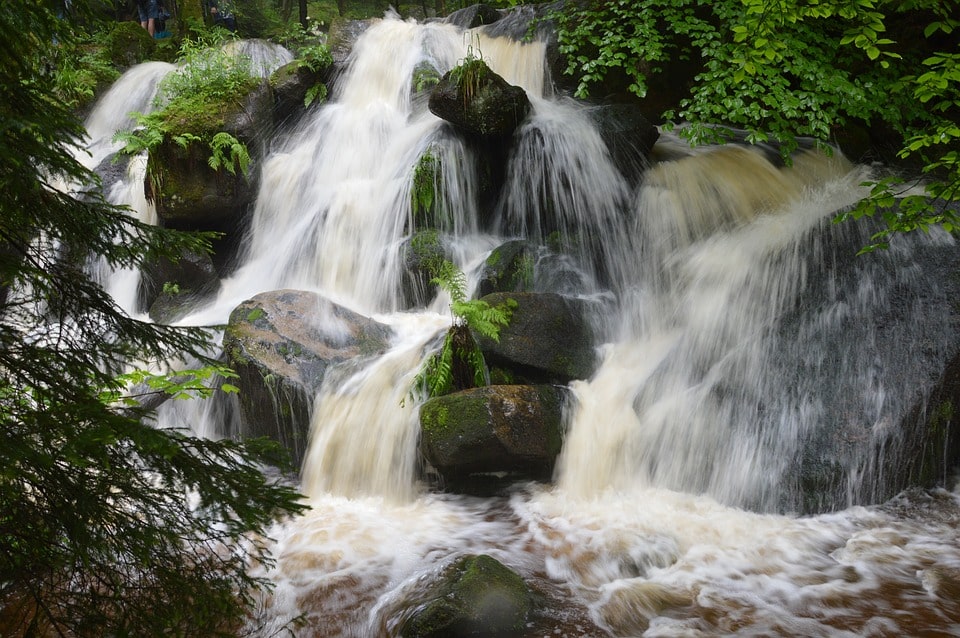
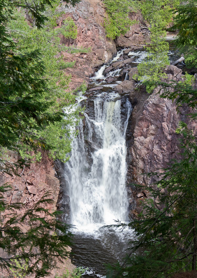
Every Wisconsin waterfall offers different scenery and terrain. Copper Falls State Park named after the copper-colored water cascading down brownstone rocks has limestone pathways directly from the parking lot through the park allowing easier access for those with limited mobility.
Location: Bayfield County, WI
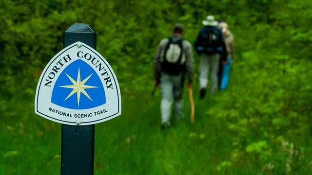
The North Country National Scenic Trail is the longest in the National Trails System, stretching 4,800 miles across eight states from North Dakota to Vermont. Hike , traverse forests and farmlands, remote terrain and bustling communities. Whether you’re looking to wander, hike, or run, birdwatch, camp, or backpack, the North Country Trail offers you a multitude of landscapes and opportunities.
.
Location: Forest Road 199, Marengo
This area represents 5,000 acres of unfragmented forest, which includes exposed cliffs, streams, the 70-foot Morgan Falls, and a breathtaking overlook at the top of St. Peter’s Dome (known locally as Old Baldy) which has an excellent view of Chequamegon Bay of Lake Superior and the Apostle Islands.
Trail to Morgan Falls is 1.2 miles round trip.
Trail to St. Peter’s Dome is 3.6 miles round trip.
Location: Mellen, WI
Ancient lava flows, deep gorges and spectacular waterfalls make Copper Falls State Park one of Wisconsin’s most scenic parks. Log buildings built by the Civilian Conservation Corps in the 1930s add to the park’s charm. The park offers camping, hiking, bicycling, picnicking, fishing and swimming opportunities in Loon Lake. The 1.7-mile Doughboy’s Nature Trail, along the Bad River, is one of the best hikes in Wisconsin.
Location: Bayfield County, WI
The Chequamegon side of the forest covers about 858,400 acres in Ashland, Bayfield, Sawyer, Price, Taylor, and Vilas counties. The name Chequamegon is derived from an Ojibway word meaning “place of shallow water,” and refers to Lake Superior’s Chequamegon Bay. During the 17th century growing numbers of Europeans and Indians made the Northwoods their home.
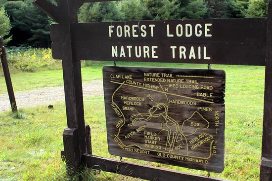
Location: Garmisch Road, Cable, WI
The Forest Lodge Nature Trail is an interpretive trail 1.5 mile loop which is maintained in cooperation with the Cable Natural History Museum. The Extended Nature trail loop adds an additional 0.5 miles to the Forest Lodge Nature Trail.
Location: Northern Bayfield County, WI
Madeline Island is the largest of the Apostle Islands and the only one with year ’round residents. The island is accessible by ferry most of the year and by ice road when the ferry isn’t running.
Location: County Hwy D, Grand View, WI
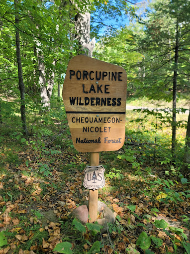
Officially designated as a wilderness in 1984, this 4,446 acre wilderness is located 4 miles southeast of Drummond, Wis. in Bayfield County. Some of the wilderness contains rolling hills covered with oak, maple, hemlock and white pine. The remainder of the area is fairly flat. Many streams contain trout. Porcupine Lake and Eighteen Mile Spring Pond have good fishing for trout, bass, panfish, and northern pike. W The North Country National Scenic Trail runs the length of the area. Branded posts mark the trail location at some intersections.
Location: 48755 Old Grade Road, Cable, WI
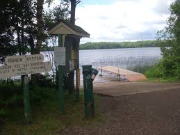
This small park provides the only public access to this very deep lake. The lake provides good fishing with populations of northern pike, walleye, largemouth bass, smallmouth bass, and panfish. Park and boat launch use are free.
Location: Drummond, WI
The total area encompasses 6,583 acres, located 4 miles north of Drummond. Among the unique features of this wilderness are the numerous narrow gauge railroad grades that were used for log hauling in the early 1900s. The North Country National Scenic Trail, which runs the length of the wilderness (north to south), and the Anderson Grade Trail (east to west) follow parts of these old grades. These trails provide access to a variety of lakes that are great for fishing.
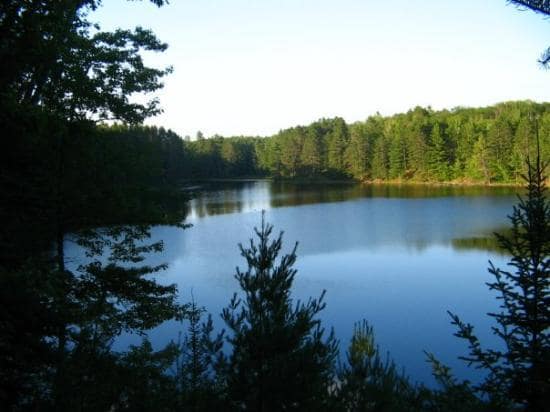
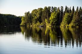
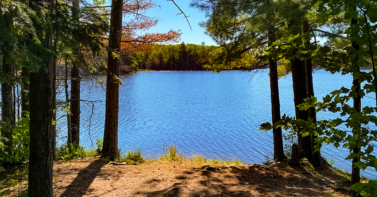
The Cable Area has plenty of water for playtime, with over 193 lakes in the area, we’re a perfect destination for water activities! Whether you want a quiet day on the lake or a active family day of water overload, we have a variety of locations for you to choose from.